News
Published in: Wind, Press Releases
Over the past year, APEM Ltd, part of APEM Group, has refined its digital aerial survey (DAS) methodology to deliver even greater confidence in environmental data. By integrating Inertial Measurement Unit (IMU) and Global Navigation Satellite System (GNSS) technology, we've significantly reduced uncertainty in data collection, providing increased assurance to regulators and interested parties about the accuracy of impact assessments.
This enhanced precision allows us to accurately determine the position and movement of the survey aircraft, including roll, pitch, and yaw, resulting in more reliable positional and effort (surveyed area) data for our clients' projects.
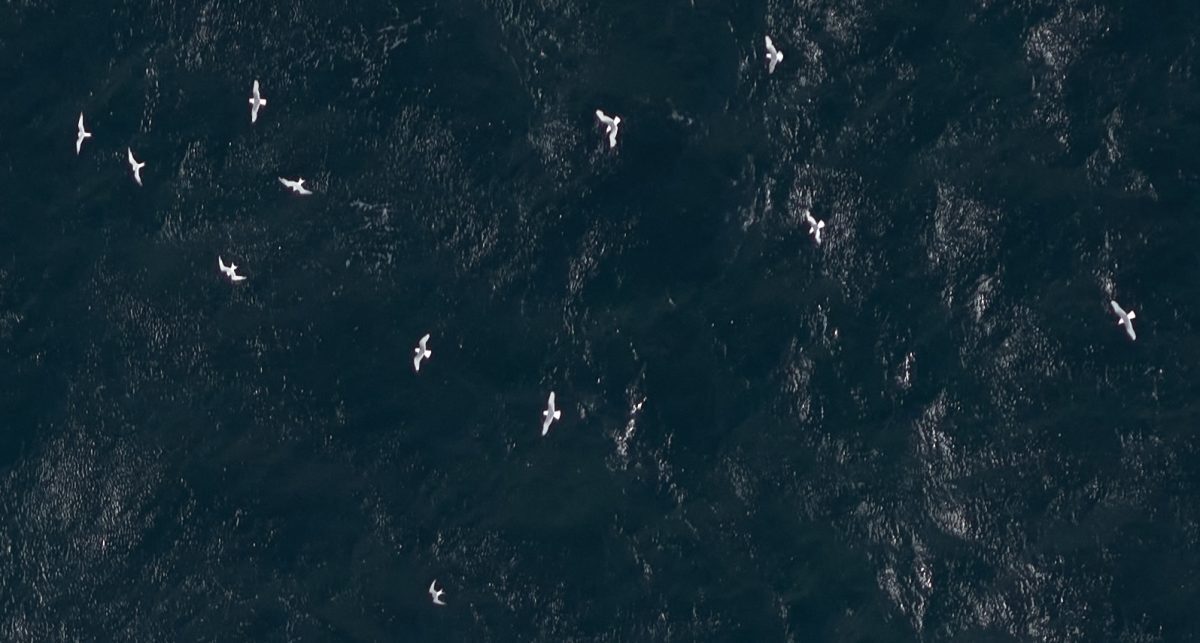
Using still imagery, our DAS methodology provides high-resolution data on the abundance and distribution of wildlife, making it APEM's gold standard for baseline characterisation.
Beyond initial assessments, DAS is used to reliably monitor the wildlife population dynamics and spatial patterns over time, supporting post-consent studies and broader strategic initiatives like regional colony counts, large-scale surveys, and evidence-based conservation monitoring.
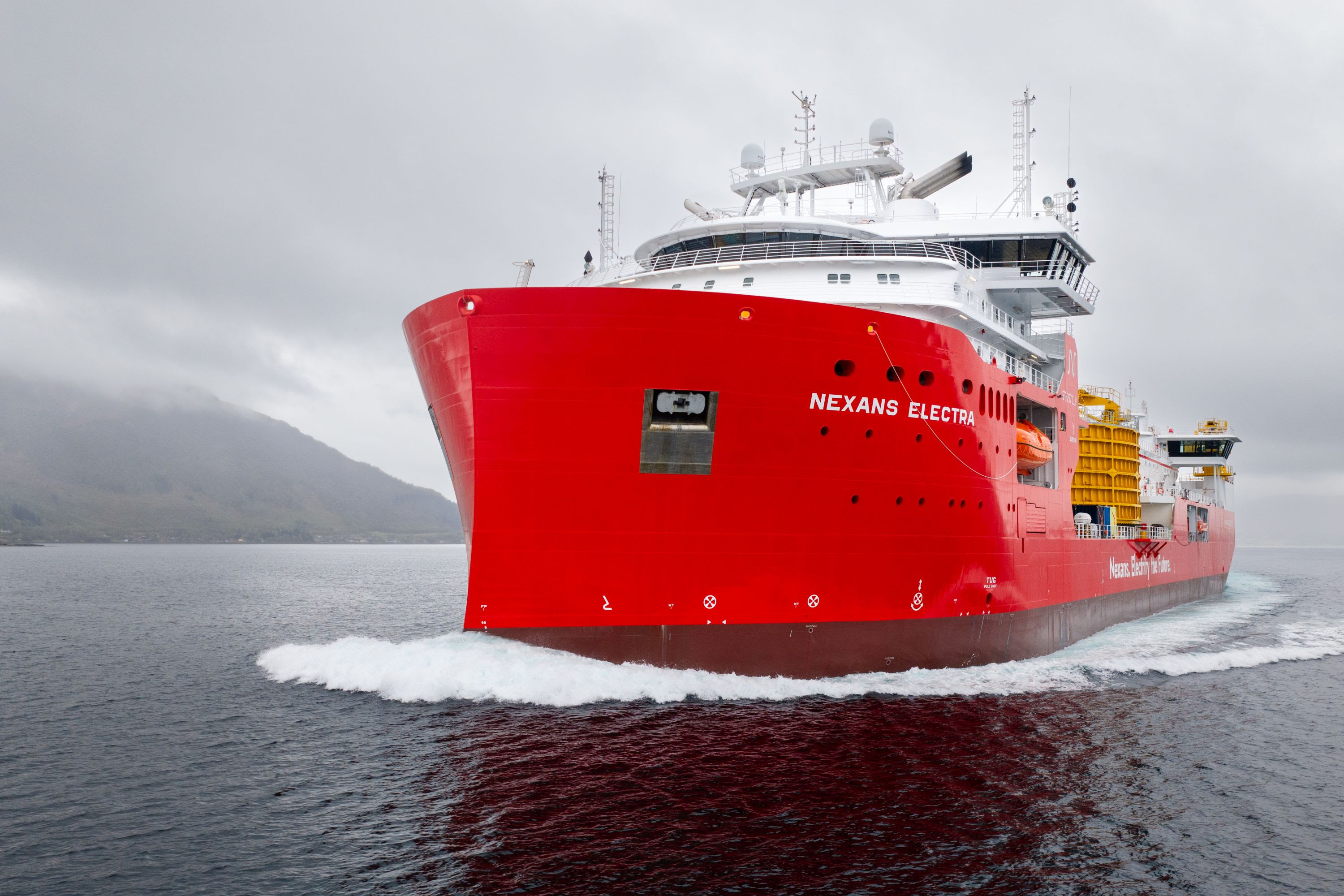
These services support a wide range of industries, including water, onshore and offshore renewables, infrastructure, power and utilities, marine and ports, construction and development, transport, and environmental consultancy.
Advantages of APEM's Digital Aerial Surveys
To help clients navigate the consenting process with confidence, APEM's DAS mitigate uncertainties in data collection, providing reliable and precise information for impact assessments.
- Ultra high-resolution imagery
- Improved georeferencing and positional accuracy of marine wildlife targets
- Reliable directionality and flight height data
- Optional Light Detection and Ranging (LiDAR) for increased flight height accuracy
- Full data validation or re-evaluation
- Consistent methodology across pre- and post-consent surveys
- Flexible survey design including transect and grid-based options.
The Importance of Accurate Data in Ecological Monitoring
At APEM, we understand that scientifically robust data is the cornerstone of effective ecological monitoring. Our baseline characterisation surveys and environmental impact assessments (EIAs) for offshore wind developments are built on precise survey methodologies. Accurate data is essential for informed decision-making and successful project progression.
Committed to continual improvement, APEM regularly monitors and reviews our survey methodologies to ensure we deliver robust and accurate data. When new methodologies emerge, we rigorously evaluate and compare them against our current standards. If they meet our stringent criteria, we integrate them to enhance our methodological standards across all projects. This was the case with survey-grade IMU and GNSS receiver technology, which has significantly improved our data accuracy.
The Importance of IMU and GNSS Technology
IMU offers continuous, precise data on the survey aircraft's position and movement, covering roll, pitch, and yaw. GNSS includes all satellite positioning systems, making it more robust than GPS alone by providing access to multiple satellite systems for better signal availability, enhanced satellite tracking and faster positional updates to improve accuracy. By using IMU and GNSS technology, APEM ensures highly accurate positional information for survey efforts and marine wildlife targets, with an accuracy of at least ± 3 meters.


The Benefits of Still Imagery in Surveys
Traditional survey methods often rely on transect-based designs, but APEM's preferred option of still imagery offers a flexible range of survey design options tailored to each project's and client's needs. This flexibility allows for precise site coverage adjustments and easy adaptation to boundary changes.
APEM's ultra-high resolution still imagery provides a ground sampling distance of 1.5 cm, ensuring high species detection and identification rates. This technology enables accurate measurements of species body length, wingspan (where applicable), and directionality.
Understanding directionality is crucial for assessing species connectivity to key breeding sites or conservation areas around a development site. Additionally, still imagery supports robust avian flight height data, with the option to use LiDAR technology for enhanced accuracy, making it ideal for collision risk analysis.
An Example of How Combining Techniques Improves Survey Data
Historically, effort calculations for digital imagery were based on the planned survey altitude to create a rectangular effort. However, multiple factors impact the effort collected during a survey, and at APEM, we strive to incorporate these.
Our methodology integrates data from IMU-enabled camera systems and GNSS, considering measured altitude, yaw, roll, pitch, and image angle spread. This comprehensive approach of integrating GNSS with inertial technology ensures precise effort estimation and enhances the accuracy of our survey data.
Summary
Our refined digital aerial survey methodology significantly enhances the accuracy of survey data, leading to better population estimates and more reliable environmental impact assessments. By integrating advanced technologies, we ensure precise effort calculations, even under challenging conditions.